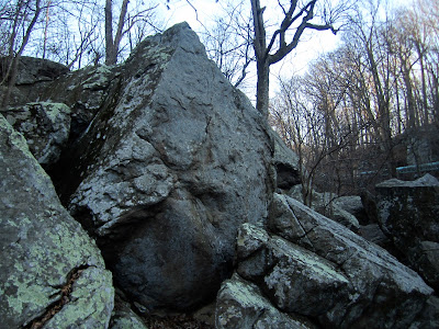
While I'd much rather be on the comfortable sandstone slopers, rails, and pockets a few hours to the west or south, I probably spend more time on the boulders at Northwest Branch than anywhere else. Partially it's convenience, the boulders being located just off Route 29 in Silver Spring, with a Trader Joe's, Starbucks, and California Tortilla just up the hill. I can generally be there by 3:30 on weekdays, leaving enough daylight for an enjoyable session even in the deepest part of winter. With 81 problems currently listed on rockclimbing.com, plenty of other unlisted climbs to be found, and the main concentration of boulders less than a five minute walk from the parking lot, it's easy enough for anyone to put together a decent circuit. Plus, most of the boulders have relatively flat landings, so a single crash pad is generally sufficient.
I'll admit, plenty of people are surprised when I tell them how frequently I go there. Sometimes it's because of the stories about NWB being a hangout for local gang members just waiting for a chance to ambush an unsuspecting climber, or the reports of animal sacrifice. Sometimes it's because they have gone there once and been unable to find anything decent to climb. I certainly can't speak for everyone, but I've never felt unsafe due to the people around me there, even climbing by myself as I usually do. Sure there are plenty of drunks, but I just say hi to them and they often end up being so interested in what I'm doing that they ask if they can watch for a bit. As for the animal sacrifice, I'll admit I've had some experience with that. Not personally sacrificing them, that is, but I did find a dead rooster at the base of the tulip boulder last year. Fortunately for me, there were plenty of other places for me to climb that day and I just moved a little further down the trail.
I would, however, caution people to be careful of ticks while climbing here. This applies to all of Maryland's densely forested climbing areas. If you find yourself brushing past vegetation, check your clothes to see if you've picked up a hitchhiker. When you get back to civilization, check your skin too. Some of our ticks are known to carry lyme disease, and that's no fun for anybody.
Regarding people's experiences of going to NWB and being unable to find anything good, I've come to the conclusion that it's best to go there first with someone who knows the area. Remember, this is Maryland. We get excited about a single boulder in the woods, let alone an entire river full of them. We put up problems on every conceivable spot, whether the boulder is 6 feet tall or 16, and then we work every possible eliminate in between just for good measure, generally giving them new names and grades in the interest of claiming a first ascent. Anyone who has climbed at Carderock should be very familiar with this experience, and even with being told that they hold they're touching is not "on." Point being, we often have to sort through lots of lower quality problems before we can get to the ones that are really good, and it's hard to do that in a single visit to NWB.
***DIRECTIONS***
According to the Montgomery County parks website, the Northwest Branch boulders are located in the Burnt Mills East Special Park at 10701 Columbia Pike, Silver Spring, MD 20901. Be aware that this address leads to the parking lot on the west side of the road, whereas the boulders are accessed from the lot on the EAST side.
Getting there is easy enough. From the north (Columbia, Baltimore, etc):
-Take Route 29 south
-Shortly after crossing 650 (New Hampshire Avenue) you'll see a shopping plaza on the left with the Trader Joe's, Starbucks, California Tortilla, etc. Go through the light and make a u-turn.
-Now heading north on Route 29, turn right into the parking lot with the old red brick building.
-The trail to the boulders is in the far corner of the lot.
From the south (Silver Spring, DC, etc):
-Take Route 29 North
- After crossing over Route 193 (University Blvd.) and going down the hill, look for the old red brick building on the right side and pull into the parking lot.
-The trail to the boulders is in the far corner of the lot.
In the image below, the red star indicates the location of the parking lot, with the shopping plaza visible next to it. The main concentration of boulders is situated approximately within the blue rectangle.
Once on the trail, you'll hit the first of the boulders in less than a minute, and most of the others are only a few minutes past there. If you go far enough downriver, you'll hit other areas before you cross under 495, but I'll come back to that in another post. There's a nicely drawn map and printable guide here. Here are some photos of the main boulders shown on the map. If the caption appears as a link, you can click on it for more information about problems in that area.
 |
| Roof Area. Across the river from the parking lot. |
 |
| Tulip Boulder Area |
 |
| Uphill Slab Area |
 |
| Crack Line Boulder |
 |
| Pyramid Boulder (Pyramid Area) |
 |
| Anklebiter Boulder (Pyramid Area) |
 |
| Suspended Boulder (Pyramid Area) |
 |
| The Gumdrop Boulders (Chaos Roof Area) |
 |
| The Floating Pyramid (Chaos Roof Area) |
 |
| The Upstream Slab (Chaos Roof Area) |
 |
| The Downstream Slab (Chaos Roof Area) |
 |
| Chaos Roof |
 |
| Bloody Buddy Boulder |
 |
| Trailside Boulder |
 |
| The Tick Area |
 |
| Dirty Ernie's Boulder |
 |
| Hobo Cave Area |


No comments:
Post a Comment